 Port Credit Marine Survey & Yacht Delivery |
10. Marks on The Charts |
 Port Credit Marine Survey & Yacht Delivery |
10. Marks on The Charts |
| Cans, nuns, buoys, daymarkers, danger &
informational signage etc. will be collectively
referred to as “marks”. |
| From the Great Lakes through the New York
State Canal System and all the waydown the Hudson River all of the marks are pretty well laid out
and conform quite closely with the
latest
charts. From Sandy Hook at the mouth of the Hudson you can go outside to Atlantic City where the inlet is easily negotiated in
most conditions or go inside at Manasquan
(Avoid Barnegat inlet unless weather
is absolutely
perfect) but don't go inside through
New
Jersey unless you are fully up to date
with
shoaling conditions as it changes frequently. From Atlantic City your next stop could be Cape May. Be aware of the bridge height restriction of 55' in the Cape May Canal as some sailboats may have to go around Cape May to the Delaware (watch the weather and tides). None of the river mouths or inlets on the east coast show all the marks on the charts because they change position so often that charts cannot keep up with them. Some bigger structural marks are charted but these too occasionally are moved. You can bet that marks will not be where they are charted and there will be more of them than you see on your charts. remember that charts like GPS are only another tool and not the be all and end all. Every prudent mariner has updated his charts from the Notices To Mariners ... not likely ! Big ships have navigation systems that are continuously updated however this is beyond most cruisers budgets (Jimmy Buffet excepted). |
 |
| The rear range was missing ! | A Green Day mark ?. | Bigger structure more reliable. | ||
|
Marks & buoys often go astray and spring tides sometimes bury markers. We have seen daymarkers 50 yards from the water and 75 yds. From the channel. We were once passed by a nun ( no, no, no … a mark) heading in the other direction. We watched this Coast Guard ship move this 16’ “green can” more than 200yds. in less than 15 minutes. How many years do you think it will be before this move shows up on your chartplotter. The USACE commander at Chesapeake City told me they have no interest in the ICW small craft route and only do sporadic dredging at some inlets when their budget allows. |
 |
 |
|
| Another Green Daymark | and another .............. | Giant nun buoy moved in 15 minutes |
| I have a newspaper clipping from an Annapolis newspaper warning of 54 mark moves, additions and deletions in one month.Nuns and cans are moved frequently as are daymarks. We have seen a “daymark” moved in less than 10 minutes. Marks on larger structures are moved less often but it does happen. In many places only these larger marks are shown on your charts as others are moved so often they cannot be | |
| charted. Marks from Lake Ontario down through the New York State Canal System to the mouth of the Hudson are pretty reliable and usually match what you see on the chart. From this point on however your charts should be considered much like stop signs in the Bahamas, merely a suggestion ! Before venturing seaward under the Verazano Bridge you have dutifully studied your charts and have identified all the marks you will follow to Atlantic Highlands or Great Kills harbours. The next morning you weigh anchor and when you come under the bridge you are hit with sixty marks that are not on your chart ! Trying to find the ones you want amid the traffic of high speed ferries, tour boats, tugs, ships, pilot boats, water taxis, head boats and small fishing boats and thick salt spray on your windshield may not be easy. This river mouth like all the inlets and other mouths you will encounter are ever changing and consequently only the major fixed marks may be where you expect them.Fortunately this busy harbour and river mouth carry a lot of commercial traffic and for that reason all marks and channels are well maintained. |
 Charts ain't perfect. Can you spot the error ? |
The following examples show why GPS/ radar/ chart plotters and charts are “navigational aids” and not navigational absolutes. |
|
 Once south of Beaufort NC the river mouths
and inlets are even more changeable
with
the area around Jekyll Island GA being
the
worst. We were supposed to round this green daymark,
I don't think so. Once south of Beaufort NC the river mouths
and inlets are even more changeable
with
the area around Jekyll Island GA being
the
worst. We were supposed to round this green daymark,
I don't think so. |
 At Lockwoods Folly Inlet (mile 320 NC) , chart shows 4 marks within the yellowcircle….. we counted 18 ! Piloting through some of these maze areas while also trying to read the chart would be very difficult. Fortunately Laura is an excellent navigator, so while I keep my eye 30’ in front of the boat Laura handles the plotting and this makes life much easier underway. |
 |
|
| As shown above, the view out the window is
often quite different from what you
see on
the chart. My nail clippers on the
chart
show our location and direction. Almost
all
of the charted land shown is under
water.
Perhaps this will be re-surveyed and
charts
updated in a decade or so. |
|
 Nassau Sound anchorage entrance at mid tide – X marks the spot where chart Chart shows 7’ @ MLW (mile 731) and a Skipper Bob recommended anchorage. We found mud flats. Luckily we had an alternate anchorage planned as light was fading fast |
|
| Below is an excerpt from the Salty South East Cruisers Net an indispensable site for updates on ICW
conditions. |
| II. Shoaling Worsens at AICW/Carolina Beach
Inlet Intersection (North Carolina AICW,
near St.M. 293) Beginning in early fall, we began receiving postings here on the Net that shoaling was once again rearing its ugly head at the AICW/Carolina Beach Inlet intersection, south of Wrightsville Beach, NC. Waterway veterans will remember that about three years ago, this juncture was all but impassable at low tide. Then, dredging took place, and all was well for awhile, but NO MORE! Just this morning (12/14/09) we have posted two important messages on the Net concerning this errant intersection. One describes several vessels grounding here near the time of HIGH TIDE! The other gives very specific advice as to how best to avoid these shallows. |
 |
|
| Three views of the same spot. Land is barely above the water level and radar is a big help in finding the channel. |
 |
 |
| See the guy standing in the water fishing.
The chart said there was 12’ at MLW in that spot. |
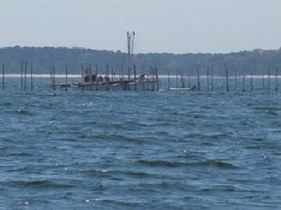
Watch carefully for “Fish Trap Area” marked on your charts. That means they could be anywhere within a few miles of the spot indicated. |
Chapter 11. Navigation Equipment. Back to Index Need a marine surveyor in Ontario... See this list of Every Marine Surveyor in Ontario 
|
|